Serra Grande, Alagoas, Brazil
FORMIND was applied in the forests of the Serra Grande sugar mill property, located in the BNAF of the state of Alagoas, Brazil, in order to study the long term impacts of forest fragmentation. The property comprises approximately 9000 ha of forest, entirely surrounded by a stable, uniform and inhospitable matrix of sugar-cane monoculture. It is located in a low-altitude plateau (300–400 m a.s.l.), characterizing the remnants as lowland terra firme tropical forest. In relation to its phenological behavior, the fragments represent two types—evergreen and semi-deciduous forests, containing 219 species according to the field data, distributed among 5 main families: Leguminosae, Lauraceae, Sapotaceae, Chrysobalanaceae and Lecythidaceae (Pôrto et al., 2006).
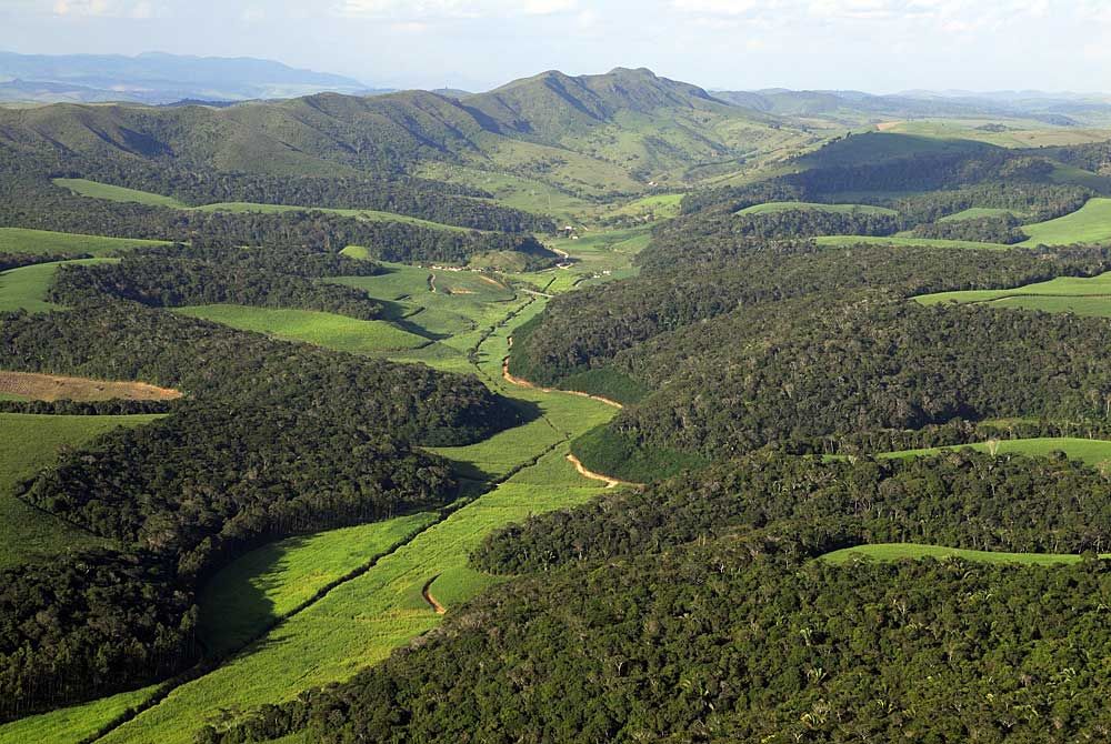
The local climate is classified as Aw (Peel et al., 2007), with a 3-month dry season from November to January, and an annual rainfall of 2000 mm. The Serra Grande landscape contains two dystrophic soil types with high clay content, yellow–red podzols (70%) and yellow–red latosols (30%) (IBGE, 1985; ZAAL, 2009), according to the Brazilian soil classification system.
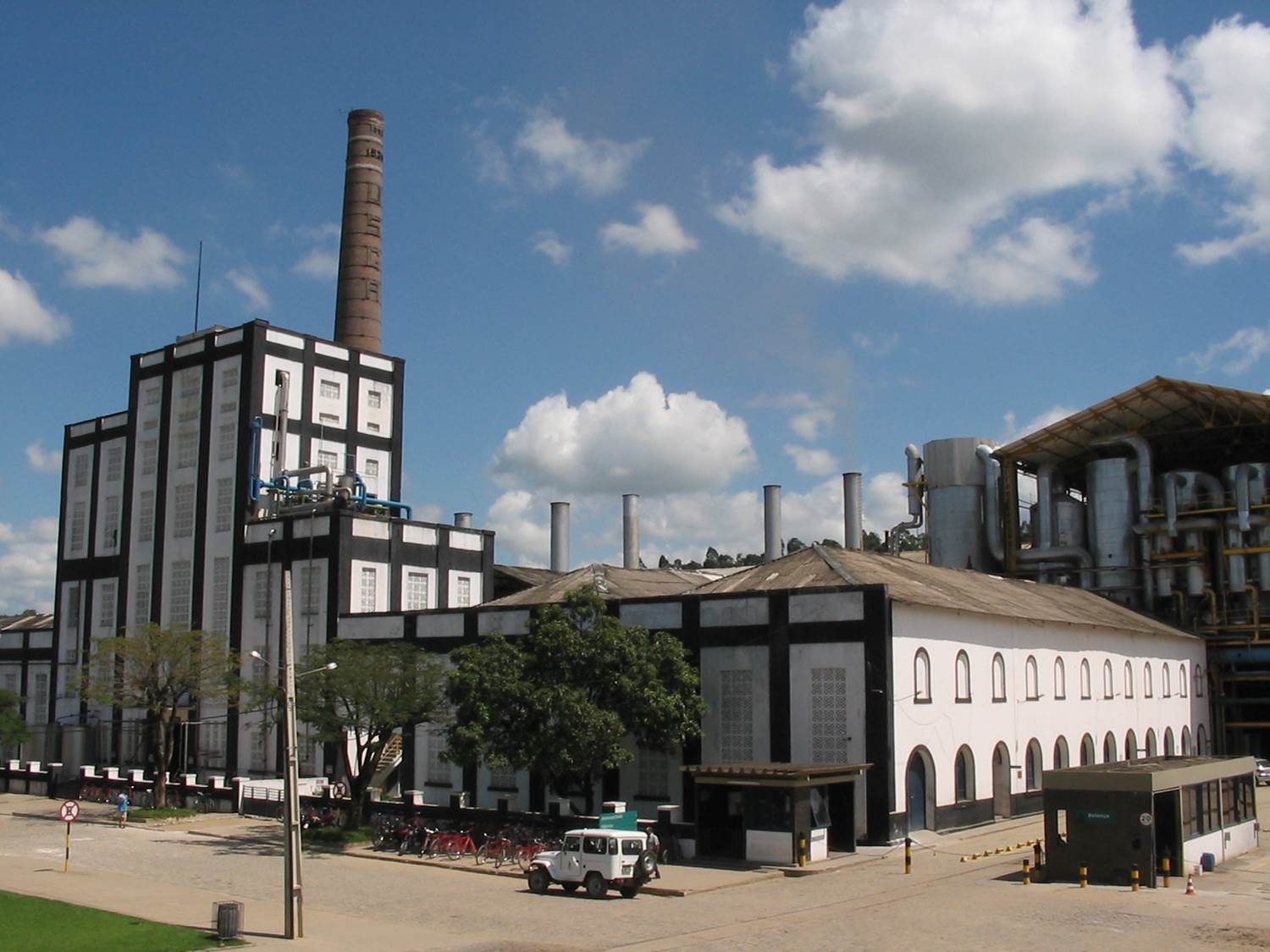
Sugar cane cultivation and forest clearing in the Serra Grande landscape started in the 19th century, and to ensure watershed protection and water supply for sugar-cane irrigation, forest fragments have been strictly protected against disturbances such as wildfires and logging. Only 9.2% of forest cover is left, including the 3500-ha Coimbra Forest—considered to be the best preserved large forest fragment in the region (Oliveira et al., 2008). Coimbra still retains a full assemblage of plant species, although large mammals such as tapirs and white-lipped peccaries have been extirpated throughout the region due to overhunting.
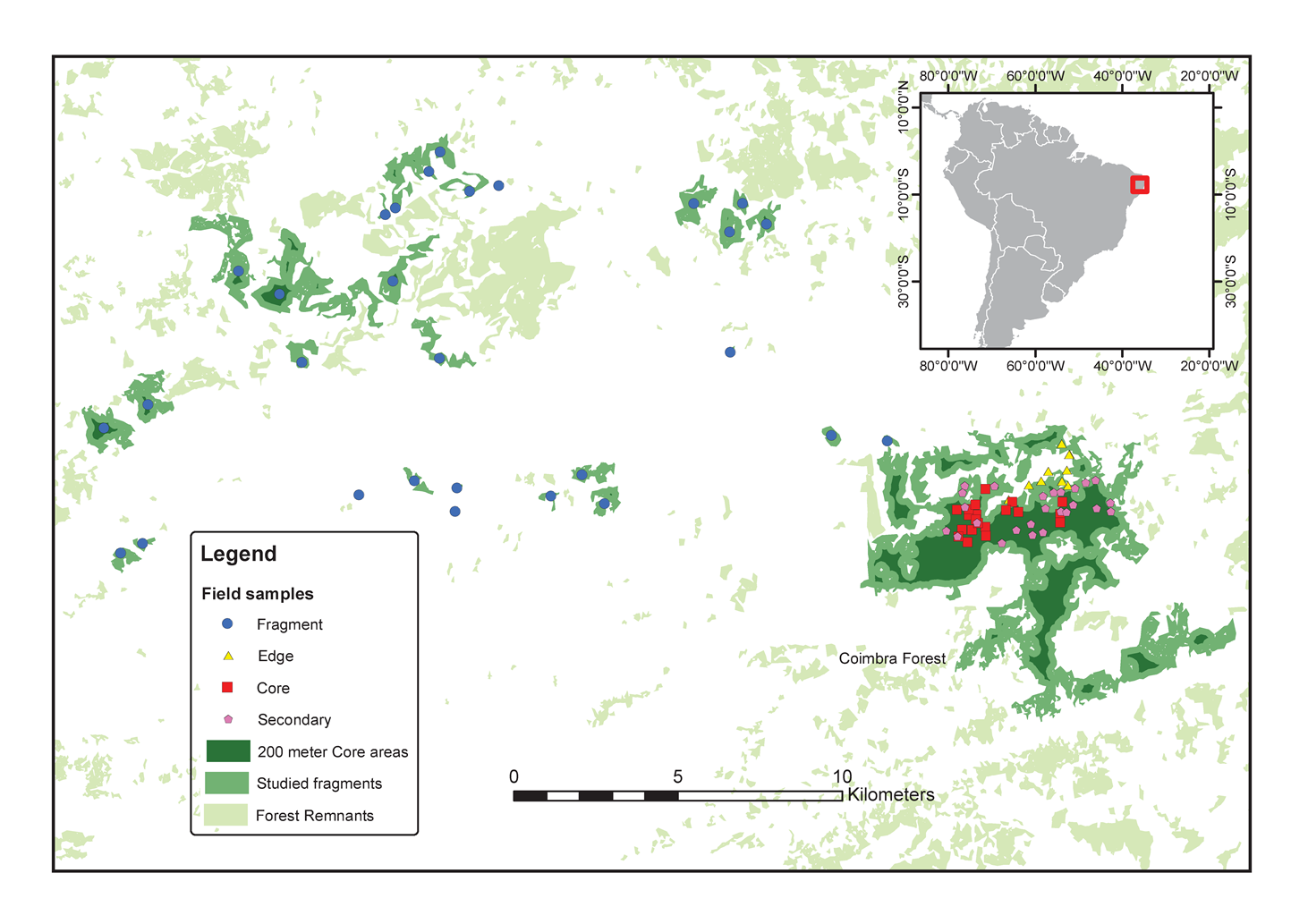
The Serra Grande landscape was studied with the FORMIND model in order to understand forest dynamics, as well as their ecological processes, in long term fragmented landscapes. To parameterize the FORMIND model, a databank on forest inventories from 75 field plots in the Serra Grande landscape (Santos et al., 2008) was used, each of 0.1 ha (10 × 100 m) where all trees >10 cm diameter at breast height (DBH) where identified to species level, and measured for height and DBH. We used plots from 4 different habitat types: 1. Edge of large fragment—10 random samples (1 ha) located in peripheral areas within 100mof the border of the Coimbra Forest; 2. Core of large fragment—20 random samples (2 ha) randomly placed at >200mfrom the Coimbra Forest edge; 3. Small fragments— 30 plots (3 ha) located in the geometric center of 30 fragments ranging between 3.4 and 295.7 ha. In order to find important parameters such as maximum yearly DBH growth, we used as a reference 25 secondary forest plots (2.5 ha) placed within 25 different secondary forest patches (one plot per patch), with known ages varying from 5 to 65 years of natural succession following slash-and-burn subsistence agriculture (maize, cassava, beans).
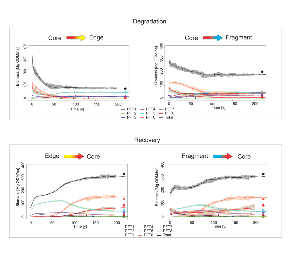
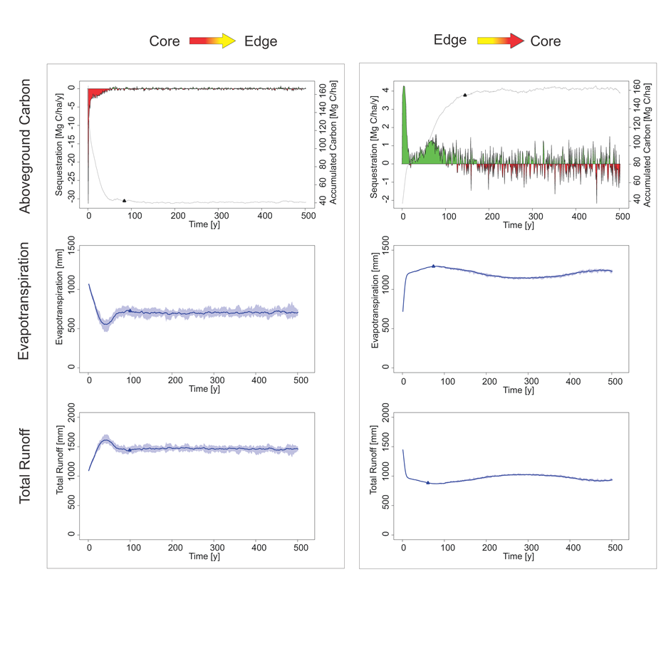
Using FORMIND it is possible to visualize the time scale in which edge effects influence tropical forests by performing 500-year simulations. We observed changes in community composition, aboveground biomass, total evapotranspiration and total runoff. Averages from ten four-hectare simulations show forest biomass degradation lasting around 100 years. If edge effects cease, recovery of biomass lasts around 150 years. Carbon loss is especially intense during the first five years after fragmentation, resulting in a decline of over 5 Mg ha−1 y−1 C. Finally, edges of large fragments face an evapotranspiration loss of 43% and total runoff gains of 57% in relation to core areas of large fragments, suggesting that fragmented landscapes can be of significantly lower value in terms of ecosystem services.
References
Pôrto, C., Almeida-Cortez, J.S., et al., 2006. Diversidade Biológica e Conservação da Floresta Atlântica ao Norte do Rio São Francisco. Ministério do Meio Ambiente, Brasília.
Peel, M.C., Finlayson, B.L., et al., 2007. Updated world map of the Köppen–Geiger climate classification. Hydrol. Earth Syst. Sci. 11 (1633–1644).
IBGE, 1985. Atlas Nacional do Brasil: Região Nordeste. IBGE, Rio de Janeiro.
ZAAL, 2009. Zoneamento Agroecológico de Alagoas—Mapa de reconhecimento de baixa e média intensidade de solos. EMBRAPA.
Oliveira, M.A., Santos, A.M.M., et al., 2008. Profound impoverishment of the large-tree stand in a hyper-fragmented landscape of the Atlantic forest. Forest Ecol. Manag. 256 (11), 1910–1917.
